Saint Lucia. Or: Whether not to go home?

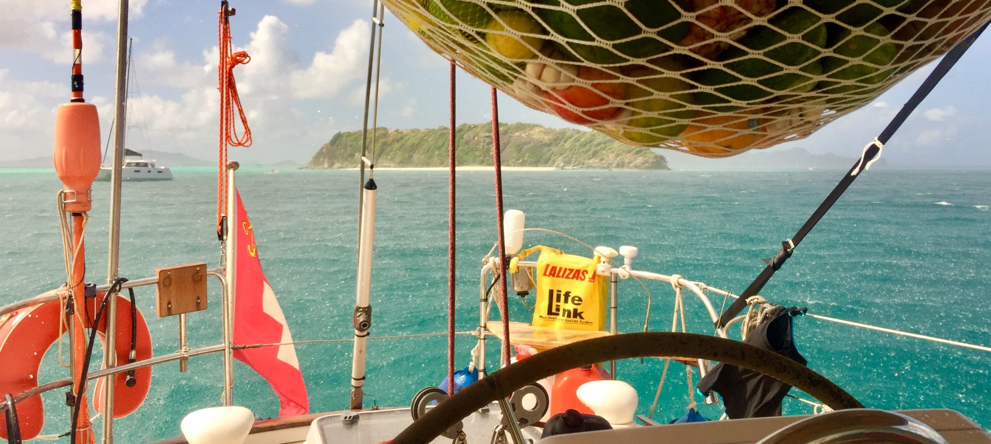
After having spent beautiful times in the South of the Lesser Antilles we felt the urge to move a couple of steps North. From Bequia, it was a fairly long day trip to Saint Lucia. We passed the main island of Saint Vincent and sailed all along the coast of Saint Lucia towards its northerly situated Rodney Bay.

That ride took a bumpy start: Just after lifting the anchor in the well protected Admiralty Bay, I set all sails. The sun wasn’t yet up and it was still dark. Leaving the last rocks of Bequia behind, the wind started kicking in. Yuana sailed very fast, but the steering wheel required more and more force for keeping the boat on course. Yuana desperately wanted to turn into the wind. What was wrong?

The wind increased much stronger than expected, 28 knots from the side, 60 to 80 degrees. With all sails all up, we were simply overpowered and far away from a nice balance between wind direction and force versus sail area and trim. So we reefed the first time before the day really started.

Saint Lucia was intended to be a short maintenance and duty free refueling stop on our way to Martinique. We got the boat nicely polished all around and in the cockpit. Then we hired a rigger to check the mast and all relevant parts of the rig. He was very satisfied with the condition of everything, and so were we. The Volvo dealer however had no time for the big engine maintenance. Most workshops are super busy because the yacht charter business moved South after the storm damages in the North. Upon leaving the country we bought 350 liters of duty free fuel at the attractive price of 0.77 Euro per liter.

So, now comes the really important part of this post. During the last weeks I read in the latest master piece of famous sailor Jimmy Cornell. The book carries the title ‘200’000 Miles’ which represents Jimmies vast high sea sailing knowledge, presented in an attractive autobiographical wrapper.

Reading the section about Southern Pacific infected me with the idea to continue our sail towards the Pacific rather then to sail back to Europe. In fact I never liked the idea to sail back into cold Northern European waters, with socks around the feet and gloves around the hands. So this new idea to sail into the Pacific triggered my blueprinting same as when I got infected with the idea of a sailing sabbatical.

By the way, Jimmies most infectious sentence was “We had no pressing reason to bring such a wonderful life to a premature end.” That sentence really made me thinking whether our own trip back to Europe would come to early? Why should we not sail the Pacific?

So we said: „Hey, we are just eight sailing days away from Panama. That means that we are almost at the doorstep to the Pacific, with our own yacht. That is a super huge chance, category ‚once-in-a-lifetime‘! So do something about it!“

We went through very intense weeks of ‚what-if-planning’. I studied the routing recommendations and the wind charts for the Pacific. We studied the administrative needs to cross the Panama channel as well as the selling chances for the boat on ‘the other side’ of the world. We contacted our municipality and school at home. It seemed that there were no killer criteria for an extended trip. There would have been ways to handle everything.

We would have left the Westindies during the first half of February. Our routing schedule was Martinique – Bonaire – Columbia – Panama (channel crossing) – Marquesas – Tahiti – Cook Islands – Fiji – Australia. We would have arrived in Sydney in late October 2018. The idea was to sell the boat there.

Our heads were deep in these questions since Grenada. Saint Lucia just became the place where we would take a decision. We did, and we decided to turn back to Europe as per the original schedule.

The most practical reason why not to go was that we couldn’t answer one key question: How to take responsibility for the family during the loooong leg from Panama to the Marquesas in case of an extended period of unfavorable weather, and one adult being down with a major thickness of injury? That leg is enormously 3’750 nautical miles long, almost 7’000 kilometers. Our standard traveling time would have been 27 days, easily 35 with low winds, perhaps again considerably more in a state of emergency.

That trip is absolutely doable and hundreds of private yachts are doing it every year, amongst them also friends of us from our Atlantic crossing. There were days where we were totally convinced that we should do it. On the next day our internal indicators pointed into the opposite direction. We gave ourselves the time to narrow down on this outstandingly great question. Towards the end we involved family and some friends. Finally we found a solid conclusion which is the right one for us. So, we intend to be back in Switzerland around July, 2018.

That is our season review about Saint Lucia. What about the island itself? We simply don’t know. There were other priorities which took most of our time.

Auf dem Weg nach Hause

Wir haben heute morgen um 9:30 Uhr Lokalzeit das Südwestkap von Grenada, den Point Saline, in nordwestlicher Richtung passiert. Wir waren damit rund 7550 Kilometer Luftlinie (natürlich mit Erdkrümmung) von zu Hause entfernt und weniger als 100 Kilometer von Venezuela’s Gewässern entfernt. Uns allen geht es bestens und Yuana macht einen super Job!

Vor allem aber heisst das, dass wir nun geographisch gesehen auf dem Heimweg sind. Auch wenn wir noch nicht wirklich bald nach Hause kommen wollen, so ist das trotzdem eine tolle Sache für einen Montagmorgen!

Die Kiddies fragen, was unsere Freunde und Leser an diesem Morgen gerade tun. Also machen wir doch ein kleines Spielchen, wenn ihr Lust dazu habt.

Liebe Leser: lasst uns wissen, was ihr heute Montag gemacht habt, und wie es euch dabei ging. Wir fassen dann anonym zusammen und lassen euch die witzigsten Antworten auf selben Wege wissen.

Karibische Reisepläne nach dem Sturm

Im September 2017 trafen die gewaltigen tropischen Wirbelstürme Irma und Maria auf die Kleinen Antillen. Sie hinterliessen teils überaus verwüstete Inseln, viel zu viel Not und Leiden lokaler Bevölkerungen, und verunsicherte Crews auf vielen Fahrtenyachten. Ein signifikanter Teil der Inseln auf unserer karibischen Reiseroute von Barbados über Grenada in die Britischen Jungferninseln war und ist davon betroffen.

Auch wenn für uns der Weg das Ziel ist, so wollen wir primär in die Karibik, und nicht primär über den Atlantik. Daher stellte sich für uns die ernsthafte Frage, wie viel Sinn die weite Reise über den Atlantik macht. Also versuchten wir anhand einer dünnen Faktenlage, uns eine Übersicht zu verschaffen. Hier ist unsere laienhafte Auslegeordnung in vier Teilen:


A) Verlängerung der Sturmsaison?

Die Sturmsaison in der Karibik dauert normalerweise von Juni bis November. Die Stürme bilden sich in den Kapverden, und ziehen dann über den Atlantik. Meist drehen sie nach Norden ab, bevor sie auf die Kleinen Antillen treffen, und lösen sich auf. Sehr starke Stürme bilden sich, wenn das Meerwasser besonders warm ist. Sie laufen länger und treffen eher auf Land. Wenn im Herbst die Sonne weiter südlich steht, nimmt die Wassertemperatur ab, und das Risiko grosser Wirbelstürme sinkt stark ab.

Im letzten Jahrzehnt lag die Anzahl sehr starker Stürme in der Karibik deutlich unter dem langjährigen Durchschnitt. Die Häufung im Jahre 2017 geht auf eine aktuell hohe Meerwassertemperatur zurück. Man muss kein Wetterfrosch sein um zu verstehen, dass die Meerwasserabkühlung länger dauert, wenn das Wasser wärmer ist. Ergo versteht der Laie, dass sich die Sturmsaison etwas über November hinausziehen könnte.


B) Etwaige Auswirkung auf unsere Atlantiküberquerung

Seit jeher planen wir, über die Kapverden in die Karibik zu segeln. Man kommt so schneller in den Passat-Windgürtel und verkürzt die eigentliche Atlantiküberquerung von drei auf zwei Wochen. Damit verringern sich die Unwägbarkeiten über das Wetter. Unsere Ankunft auf Barbados erfolgt normalerweise um den 5.-8. Dezember. Barbados liegt am unteren Ende der Hurrikan-Zugbahn. Wir haben keine Anhaltspunkte gefunden, wonach es so spät im Jahr auf Barbados einen tropischen Wirbelsturm gegeben hätte. Trotzdem wollen wir uns gedanklich einige Eventualitäten durchspielen:

Sollten zum Zeitpunkt der Abfahrt in den Kapverden deutliche Abweichungen zur üblichen Passat-Konstellation erkennbar sein, so könnten wir die Abfahrt hinauszögern.

Sollten wir unterwegs von einem sich bildenden Hurrikan überholt werden, so würden wir diesen zwei bis drei Tage im Voraus erkennen, und könnten nach Süden ausweichen.

Sollten wir sehr weit ausweichen müssen, so könnten wir Surinam oder Französisch Guyana auf dem südamerikanischen Festland anlaufen. Letzteres ist ein EU-Gebiet.


C) Zustand der beschädigten Inseln zum Zeitpunkt unseres Besuches

Die dortigen Völker und Vegetationen sind sich an ‘normal starke Stürme’ und das Beseitigen deren Schäden gewöhnt. Weil fast die gesamte Wirtschaft vom Tourismus abhängt ist man sehr bemüht, die Inseln bis zum Beginn der Reisesaison wieder ‘geniessbar’ zu machen. Einige der wüst getroffenen Inseln sind EU-Gebiet. Diese Inseln haben bereits weitreichende Hilfen erhalten. Einige der stark beschädigten Inseln werden wohl wieder einigermassen funktionieren, bis wir ankommen. Wie es um die zerfetzten Palmen steht, werden wir dann sehen.


D) Allfällige Alternativrouten

Tatsächlich wird es wohl so kommen, dass wir gewisse Ziele nicht werden besuchen können. Anhand einer selbstgebastelten Karte wollten wir verstehen, wie viele der bisherigen Ziele möglicherweise ausfallen müssen, und wie sinnvolle Ersatzziele heissen könnten. Dabei war zu berücksichtigen, welche Routen zu den jeweiligen Jahreszeiten bzw Windrichtungen überhaupt gesegelt werden können. Zum Beispiel wäre es sehr mühsam, jetzt gegen den Wind ins Mittelmeer segeln zu wollen.

Mehr als ein Duzend Reisevarianten standen plötzlich zur Disposition. Die kürzeste Extremvariante war, den Winter in den Kanaren zu verbringen, um im Frühling über die Azoren nach Kontinental-Europa zurückzukehren. Dabei hätten wir von der Karibik abgelassen. Die längste Extremvariante war, nach einem Kurzbesuch im Süden der Karibik in Richtung Panamakanal weiterzusegeln, um schliesslich die Nordamerikanische Westküste zu erkunden. Wir hätten das Schiff dabei im Sommer 2018 in San Francisco, Seattle oder Vancouver verkauft. Zu diesen und anderen Varianten gibt die Karte im Titelbild Aufschluss. Natürlich ist das eine Momentaufnahme, welche sich – hoffentlich zum Besseren – ändern wird.


Zusammenfassung

Wir sind überzeugt, dass wir den Atlantik zur Passatwindzeit werden sicher überqueren können. Sodann werden wir länger als geplant auf Barbados, Grenada und Sanct Vincent and the Grenadines bleiben. Bis wir zu den nördlichen Inseln vorstossen, sollte ein Teil der Schäden behoben sein.

Einige Inseln wie Dominica oder Barbuda werden wir wohl nicht besuchen. Vielleicht werden wir sogar die Jungferninseln nicht anlaufen. In diesem Falle kann unsere Rückfahrt auch ab Antigua direkt auf die Azoren erfolgen. Den ‘Umweg’ über die Bermudas würden wir uns dabei sparen.

Die beiden Stürme haben uns geholfen, unsere karibischen Reisepläne weiter zu konkretisieren. Ein Verzicht auf unser karibisches Abenteuer und die zweimalige Atlantiküberquerung scheint zum aktuellen Zeitpunkt nicht angebracht zu sein. Diese Einschätzung werden wir zu gegebener Zeit natürlich wieder überprüfen. Wir halten uns alle Option offen und werden jedenfalls kein Wagnis eingehen wollen.

Navigation in Southern North Sea

Navigation in Northwestern Europe is fantastic. There are various components to be considered before departing, and also on the way. This turns route planning into a strategic game with many tricky components.

Next to geography and wind direction and force, the perhaps most important item is the tidal streams. Tidal streams are motion of the entire sea, depending on actual position of earth and moon. The vast mass of moon works as a field of gravity for things on earth. If that thing is a large area of liquid (e.g. the sea), the weak gravity of moon is still strong enough to makes the liquid on earth moving. Wherever the water is drawn into a corner of land mass where it can no longer move to the side, then the sea water level will rise.

Why is this of importance to us as sailors. Lets say that a boat is traveling with a speed of 6 knots (this is what we want to see as an average). The current of the water we are travelling in has a speed of 1.5 knots. The boat against the current makes good only 4.5 miles per hour, whereas the boat going with the current makes 7.5 miles. A distance of 22.5 miles is therefore made in either 3 hours or 5 hours. Our average daily traveling distance in this first phase of out trip is however 32 nautical miles (60km).

The tide certainly doesn’t start to flow into your direction at the time you are
ready to leave. We use tidal stream maps and tables and plan departure times usually for the two traveling legs in ahead. Markus likes this game very much and will miss it, once we leave North Sea (tonight) and the English Channel (in about 2 weeks time.

By the way, doing a regatta in tidal waters requires a lot of knowledge, especially when there are submerged sand banks with changing water depth. The stream will usually be quicker in the channels, and an almost won regatta can be lost if your final course leads through shallow waters.

My regatta skipper George always said that regatta sailors are often the better cruisers. And yes, four Dutch sailing yachts confirmed that it could be like that. Three days ago, those guys were racing down the coast, ourselves being far more away from the land. For many hours it seemed that they would arrive in Scheveningen before us. The slightly bent coast line however made them going straight against wind and wave for the last two hours, and this was why we got the last nice berth in the harbor, not one of them. I was jumping with joy!

What other complications can be found out there? The better issues are objects which do not move, such as huge wind farms, containing dozens of wind mills, or off shore drilling platforms for oil or natural gas. There are fish and mussel farms, same as hundreds of ship wrecks sea bed cables and munition deposing grounds from the past. Better don’t drop your anchor there.

Movable things can include commercial vessels, and if you check on ship tracking sites such as http://www.marinetraffic.com you can easily spot that the Southern North Sea belongs to the sea areas with one of the densest cargo ship traffic in the world, same as Strait of Malacca in Singapore area.

Our issue with this is that from time to time, we have to cross this well organized shipping lanes. The big guys are usually 3 to 5 times as fast as we are. With some optical aids and transponder information from everyone, we can estimate quite well where we can still go and where we should better wait until the big guys have passed. In a shipping lane which is marked like that on the map, these guys have priority. In a more coincidental vessel crossing far out on the sea, it is the sailing vessel who has right of way, at least in theory.

When we come to the conclusion that there is still room enough to pass on front of a commercial vessel, then we want to be sure to have a plan B in case our propulsion fails in front of the other’s bow. He cannot stop, perhaps just change course by two or three degrees. For this reason we always call the big guys on the VHF radio before passing ahead of them.

Other things which are there on and off can be fishing vessels or army firing exercise. Whereas army exercise is broadcasted on the VHF, the fishing vessels move totally unpredictable, as the fish goes. These can be the toughest ones especially if sailing at night in coastal areas. It is sometimes difficult to understand where the fishermen are going, particularly when many lights from land interfere with the fishing vessels lights.

That can be what’s going out there. Usually we love it, sometimes we hate it, for example if one cannot go to the toilet just because fish have no plan where to go next 😉